The Great Fen, a vast landscape located in Cambridgeshire, England, and home to two National Nature Reserves, is currently undergoing one of the largest restoration projects of its type in Britain – the restoration and transformation of a landscape for the benefit of both wildlife and people.
What started out as wildlife recording in the 1800’s, an annual program of survey and monitoring on the Great Fen has developed into a more structured program to further understand the benefits of the restoration work being done.
Coordinated by the Great Fen Monitoring and Research Officer, Henry Stanier, the program helps to determine the effectiveness of restoration and the development of habitats and colonization of species. This involves collecting data before, during, and after an area of land is restored and the movement of wildlife within and outside the Great Fen area.
A wide range of wildlife is monitored as part of the program including birds, mammals, invertebrates, amphibians, and plants. Water and environmental data are also recorded, such as temperature, rainfall, water levels, water quality and carbon emissions.
This information then shapes the future management of the landscape and provides visibility on any connection of species movement and population with changing environmental conditions.
We caught up with Henry onsite in the Great Fen to learn more about how groundwater is measured, and the long-term benefits data collection has on the protection of wildlife and climate change.
Groundwater monitoring underpins management of the Great Fen
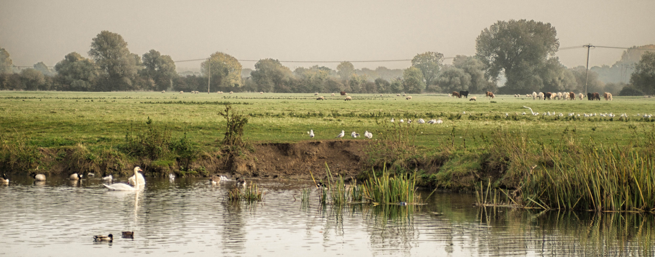
Walking through the Great Fen, watching Chinese water deer grazing in the distance, whilst a raven calls nearby and a pair of buzzards hover in the rising heat, visitors could be forgiven for thinking that they are surrounded by a natural environment untouched by human hands. However, as Henry Stanier, Wildlife Trust Monitoring and Research Officer, explains; “Nothing could be further from the truth; human activity, mostly driven by agriculture, has focused primarily on water levels, and this has had a profound effect on the local ecology.”
In 2001, five organisations came together to set out a vision for the Great Fen, with the aim of providing a more sustainable future for the area. In many respects, this work focuses on restoration by managing water levels, so a network of monitoring wells has been established. In the following article, Wendy Strain from OTT HydroMet will explain how this monitoring program is helping to achieve the ambitious goals that have been set for the Great Fen.
Background
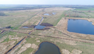
The Great Fen is an expanse of nationally significant fen landscape between Peterborough and Huntingdon. The area contains many farms and villages as well as two National Nature Reserves; Woodwalton Fen and Holme Fen.
Holme Fen and Woodwalton Fen are both part of the Great Fen, a habitat restoration project, involving the local Wildlife Trust, Natural England, the Environment Agency, Huntingdonshire District Council and the Middle Level Commissioners.
The Great Fen covers 14 square miles of land that is being restored to wild fen over a 50-100 year timescale, creating a huge nature recovery network, providing a Living Landscape for fenland species including threatened fen wildlife, such as bitterns and otters. A mosaic of different wetland habitats has been established to support a wide variety of wildlife, such as dragonflies, butterflies and amphibians. This habitat is also suitable for flowers and other plants, some of which are found almost nowhere else in the UK, such as the Fen violet and the Fen woodrush.
In 1630 a group of wealthy landowners, headed by the Earl of Bedford, set out to drain the fens for agriculture and to minimise winter flooding. Many of the local people were fiercely opposed to the draining, believing it would deprive them of their traditional means of livelihood from wildfowling, fishing and reed cutting, and a group known as the ‘Fen Tigers’ vandalised the dykes, ditches, sluices and reedbeds. Nevertheless, by the end of the 17th Century the drainage project was complete.
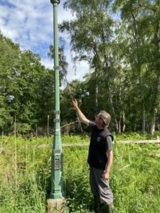
This drainage causes more problems, such as peat shrinkage, and more drainage projects followed. In the 1800s, conscious of the likely shrinking effect of draining the peaty soil around Whittlesea Mere, William Wells, another wealthy landowners, instigated the burial of a measurement post at Holme Fen, which was anchored in the bedrock and cut off at the soil surface. Today, around 4 metres of the post is showing above ground, recording the ground subsidence since 1852. The ground level at Holme Post is now 2.75 metres below sea level – one of the lowest land points in Great Britain.
Several issues have arisen as a result of the drainage. Firstly, there has been a huge impact on local ecology and biodiversity with the loss of a large area of wetland. Also, as the ground level subsided it became less sustainable to pump water up into the main drain. The loss of peat has become a major concern, because, as a carbon sink, peat is hugely important in the fight against global warming.
Peat forms in waterlogged, acidic conditions when layers of partially decomposed mosses and other bog plants accumulate. The process is very slow; it can take up to 1,000 years to form just one meter of peat. Nevertheless, around 60% of the world’s wetlands are made of peat. The plants which form peat capture carbon dioxide from the atmosphere and as a result, large quantities of carbon are trapped in the peat. However, if the peat is drained, it decomposes much faster; releasing the stored carbon. Peat burning has the same effect, but much faster.
It has been estimated that the reduction of peat loss in the Great Fen, coupled with the capturing of carbon by vegetation is saving 325,000 tonnes of CO2 from being released each year.
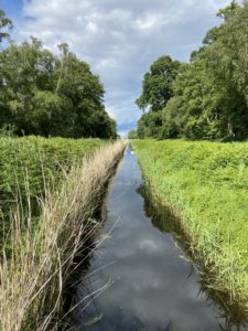
The project is also a good example of natural flood management (NFM) because it provides extra water storage after heavy rainfall, which slows water flow and helps to protect surrounding towns, villages and farmland from the risk of flooding.
Water level management
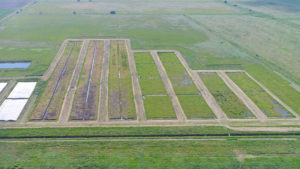
The drainage of the fens incurred widespread ecological harm, but the solution is significantly more complicated than simply raising water levels to create wetlands. Henry Stanier explains: “There are a number of factors that impact the restoration process. Firstly, the geology of the area is like a layer cake, and each layer has different hydrological properties. Secondly, the Great Fen includes a number of commercial farms, so it is important to understand and manage their groundwater status. Thirdly, the surface water requirement varies according to the time of year, due to the needs of a wide variety of flora and fauna, including breeding birds. Fourthly, along with various partners, we are conducting numerous research programs, most of which are affected by water level. For example, we have trial plots with raised water levels, in which we are investigating the performance of different plant species. These include Sphagnum or ‘bog moss’ which stores water, prevents the decay of dead plant material and eventually forms peat, and we are also trialling the wetland cropping potential of Glyceria fluitans, a robust perennial aquatic sweet grass.”
Water level monitoring
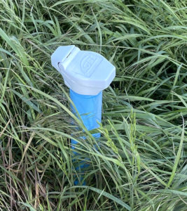
Working with a team of over 60 volunteers Henry delivers a monitoring program for the project area, which is currently around 3,700 Hectares. 40 wells have been installed in strategic locations, each to a depth of around five metres. 37 of these have OTT Orpheus Mini water level loggers, which record groundwater level every hour, every day of the year. Henry collects the data from these loggers once or twice per year, or more frequently where the data is of greater significance.
Three of the wells have been fitted with OTT ecoLog water level loggers. These devices have the ability to transmit both stored and live data to a secure website which Henry can access with any internet-enabled device at any time, and from anywhere. “This is a tremendous advantage,” he explains. “With such a large area to cover, field visits can be time-consuming and therefore costly, so we install the OTT ecoLogs in the wells of greatest interest, so that we can, for example, view the effects on groundwater levels when we transfer surface water into an area.”
Henry’s team operates a number of trial plots by the dipwells; investigating how the vegetation is changing. His team also correlates groundwater levels with vegetation growth, in order to better understand optimal growing conditions.
The Great Fen area includes a number of commercial farms, which operate both drainage and irrigation processes, so the groundwater monitoring program also helps to understand the effects of these activities. In addition, new farms are regularly acquired and incorporated into the Great Fen, so the monitoring work helps to manage the restoration of this land from agriculture to fenland.
Summary
Henry says: “Fenland restoration depends heavily on a deep understanding of the geology and the water table, and the effects of water status on the local ecology. The water level monitoring that we undertake provides the data that underpins the science that informs the important management decisions that are made. The quality and reliability of the OTT water level loggers is therefore vital, and we look forward to expanding our network of monitors as the project continues to grow.”