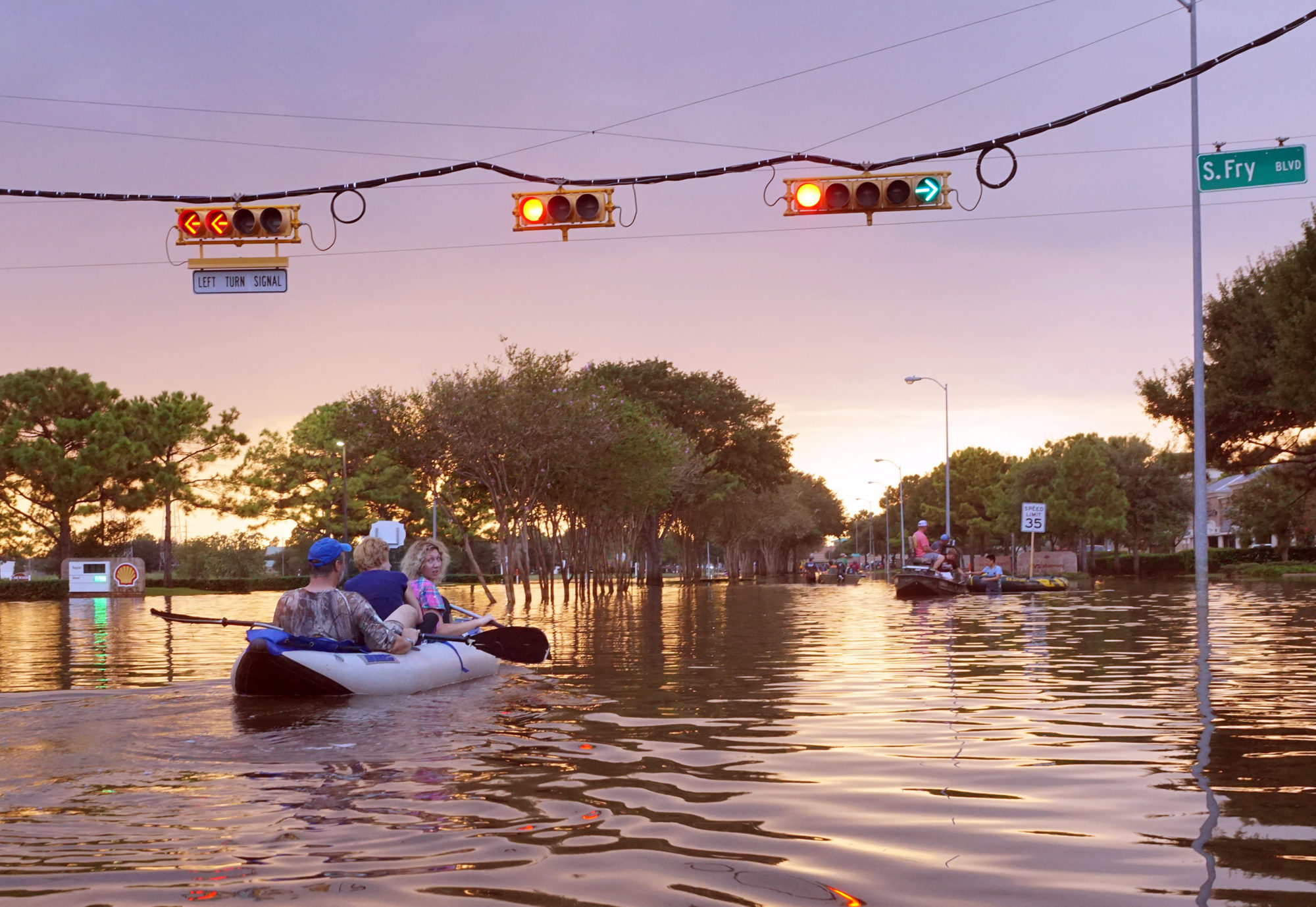
When it comes to flood warnings in urban areas, there are certain questions that we hear time and again from our customers. We’ve consolidated what the industry is most curious about and answered each of those questions below, to give you a comprehensive look at urban flooding.
1. Is flooding more of a risk in urban areas?
Urban areas with high amounts of impervious surfaces, such as cement or pavement, are indeed more susceptible to flooding, as these can create more water run-off and ponding in larger quantities. In rural areas, water can be more spread out and reenter the groundwater cycle to create less of an impact.
2. How reliable is the 100-year event system?
These systems have been used for a long period of time but recently certain examples, such as in Harris County where a 1,000-year storm and 200-year storm occurred in a period of two years, suggest these models may be a bit outdated and could use revising.
3. How much can a flood monitoring solution cost?
The upfront cost for a network depends on the scope and technology you require of your network. A minimalist network with just the essentials can likely be around $2,000-6,000 to get set up, while a more advanced network with the ‘bells and whistles’ can be upwards of $6,000.
4. How would you recommend choosing between different sensor options for water level and precipitation?
OTT HydroMet caters to many applications and situations based on your station location and more. The right solution will depend on-site specifics, which sensors you can use, whether it needs to be remote, etc. You’ll have options and some tend to be better than others depending on your needs, and our sales and support teams can provide expertise and resources to determine the best option for you.
5. Regarding electrical data collection equipment (sensors, dataloggers, solar panels, etc.): when these go under a flood, can you still receive the data?
There are measures that can be taken when equipment is at risk of flooding, and these also depend on what portions get inundated and to what extent. In-water sensors are designed to withstand water submergence. Sensors that are meant to be out of the water can withstand inundation for a certain amount of time. Dataloggers are not meant to be flooded but can be protected in enclosures (like our NEMA enclosures) that can prevent some damage from submergence, and in general, give a certain amount of protection from outside factors.
For some of the sensor technologies like the OTT Radar Level Sensor (RLS), we’ve had instances where depending on the height of the bridge the sensor is installed on, and how it was installed, it can go underwater during flood conditions and resume measuring once back out of the water.
6. How well do OTT HydroMet sensors perform in saline or saltwater environments?
Many sensors are made from materials that can withstand brackish conditions. A number are made from 904L stainless steel which is excellent for brackish conditions and highly suitable for saltwater environments.
7. How accurate are the readings from SUTRON equipment?
The equipment is very accurate, especially given the use-case of flood warnings to allow for key decision-making and sharing data with important stakeholders.
8. Sometimes monitoring data needs to be verified for accuracy. Do OTT HydroMet systems flag potential incorrect data or unusual trends?
Within many dataloggers, you can customize specific callouts for irregular readings. The equipment gives you the ability to assess and work with the data upfront. Each instrument has some sort of internal assessment assistance to determine when something is not right.
9. Is the OTT/SUTRON system compatible with other vendor types?
Our sensors are often able to work with third-party dataloggers. Our dataloggers can receive a whole host of third-party sensors. There are tools within the set-up and programming of these loggers that will recognize other types of sensors to make it even easier for you to setup with third-party equipment.
10. What different formats can the data be outputted in? How can it integrate into specific systems/models?
Our technology leverages many different types of formats that come as standard options with our equipment, both for data formats and telemetry formats. We also have Python scripting capabilities with specific products for increased customization. You can view the available format options within the SUTRON SatLink 3 here or SUTRON XLink 100/500 here.
11. What is the difference between the types of satellites for telemetry?
There are several different types of satellite telemetry options to choose from. In the US, the GOES system is what many federal agencies like the USGS use and it has been in place for a long time. In Europe, the Meteosat weather satellite series is in use. Another major option, the Iridium satellite, is more commonly used by typical city counties or private company users. Both have been refined over the years to be more cost-effective and deliver data faster for a more efficient system.
12. Is it possible to integrate a telemetry system with disaster management information systems?
OTT HydroMet’s telemetry is designed to integrate with a wide variety of real-world applications like water treatment plants, dam operation, or disaster awareness. Dataloggers can send and share information in the way almost all third-party systems need to receive it to make use of it.
13. What is the major difference between SMS alerts sent out by third-party organizations, like national data collection agencies, and local data collection efforts?
They go hand in hand. Regional data is collected in order to send out these alerts, from either local or national sources. These require someone to decide when to send out the warning and to whom. Local data collection allows a community to make its own range of decisions to inform citizens, prompt evacuations, and manage control capabilities on a more granular scale.
14. How is public data screened to supplement local data that eventually goes into models and forecasts?
With USGS as an example, the organization conducts internal quality control of the data. They use in-house expertise to turn all the data collected into useful public information, by filtering out erroneous or unnecessary data.
15. How many federal agencies use these types of data collection systems?
Many use this type of equipment, from sensors to dataloggers and more, quite extensively. The USGS, the Army Core of Engineers, NOAA, and many other federal and state agencies use these types of systems for their ease of use, accuracy, reliability, and more. They especially need it to be reliable for mission-critical situations like informing the public of an impending flood and taking action to evacuate and mitigate potential damages.
16. What is your contact email to learn more?
You can reach us at sales@otthydromet.com to work with an in-house expert to start building your custom solution today.
Watch the full webinar here to learn more about proactive data collection for flood warnings.
![]()