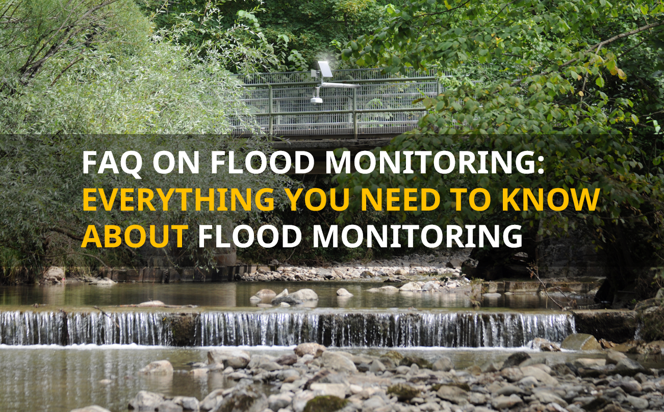
Flood monitoring is a crucial part of civil protection and urban planning. As extreme weather events become more frequent, it is more important than ever that municipalities, engineering offices and emergency services such as fire departments and disaster control are well informed and prepared. In this blog post, we answer frequently asked questions about flood monitoring to give you a comprehensive understanding.
Table of Contents
General questions
What do we understand by flood monitoring?
Flood monitoring refers to the proactive observation of water levels in rivers, lakes and other bodies of water to provide early warning of flood potential. It involves the use of sensors, data transmission, and analysis systems to continuously collect and evaluate data.
Why is flood monitoring important?
Continuous flood monitoring enables municipalities and emergency services to monitor rising water levels in real-time and take appropriate measures to protect life and property. Informed municipal managers and emergency responders can initiate evacuations, mobilize resources, in the event of an incident to mitigate exposure of citizens and property to impending floodwaters.
Later, the data obtained also makes it possible to improve models and adopt resiliency strategies.
Who needs flood monitoring?
Flood monitoring is important for various stakeholders, including:
- Mayors and city administrations: To coordinate safety measures and urban planning.
- Stormwater Managers
- Engineering firms: To develop resilient infrastructure projects and plan flood protection measures.
- First Responders: For early preparation and coordination of rescue measures and to make well-informed decisions during a flood event.
- Agriculture: For planning harvest times and protecting cultivated areas.
- Private companies: For the timely evacuation and protection of stock and machinery.
- Construction companies: For the timely evacuation of excavation pits before they are flooded. This protects not only human lives but also expensive machinery and materials.
Technical questions and answers
How to plan a measuring station?
Visit our blog: Guide to Planning a Flood Monitoring Station
What technologies are used for flood monitoring?
Various technologies are available, including:
- Sensors: Level gauges, flow meters, cameras and precipitation sensors
- Data transmission: Wireless networks, satellite communications and mobile communications
- Data analysis: Software solutions for evaluating and visualizing measurement data.
Which sensors are used?
A wide range of sensors can be used, such as level gauges, precipitation sensors, and flow meters, which enable precise data acquisition. The selection of the appropriate sensor depends on the objective of the measurement and the site conditions.
How long do the sensors last and how are they maintained
The service life of sensors varies, but high-quality sensors can operate for at least 5 to 10 years. Regular maintenance is crucial for the accuracy and reliability of data. The type and scope of maintenance depends on the sensor selected and the environmental conditions. However, with good planning and the right choice of measurement technology, the scope of maintenance can be minimized to one or two visits per year.
Precipitation measurement
How do I identify the optimum precipitation sensor for my measuring station?
There is no one “best” precipitation sensor. Each measuring principle has strengths and weaknesses that need to be weighed up when selecting the right sensor for your project.
There are two main points to consider to make the right choice:
What is the intent of my measurement?
Is it important to record the exact amount of precipitation and intensity? This is necessary to provide reliable input for hydrological models. The actual amount of precipitation can also help operators of wastewater treatment plants to control their systems more effectively. After an event, it is often necessary to prove that this precipitation event was in fact exceptionally heavy. In this case, a sensor with the highest possible measurement accuracy should be selected. Weighing systems, such as the OTT Pluvio², generally provide the highest measurement accuracy with high reliability and low maintenance requirements.
If it is more important to record the spatial distribution of a precipitation event , for example to assess the extent of the event across different districts of the city, it can be advantageous to switch to radar sensors. These are smaller and can therefore be installed inconspicuously in the middle of an urban environment. They are also cheaper, so more measuring points can be set up for the same budget. The accuracy of these sensors with regard to the amount of precipitation is worse though than that of weighing systems. However, if the data is to be used as input for an AI-supported forecasting model, for example, the better description of the spatial spread of the event can increase the accuracy of the model, even if the individual measurements are less accurate.
Is it important to know the precipitation type, i.e. to be able to distinguish between drizzle, rain, snow and hail, for example? This distinction is not possible for weighing sensors. Even tipping buckets cannot make this distinction. A radar sensor or a disdrometer (OTT Parsivel, WS100) can be used for this application. The type of precipitation and the size of the drops can provide important information on the runoff process and any erosion that may occur.
What conditions do I have on site?
Is there enough space to install a large weighing sensor? Then this is probably a good solution. If the space conditions do not allow this, you can switch to a smaller radar sensor.
What energy supply options are available on site? Precipitation sensors generally consume a relatively large amount of power compared to other sensors. Therefore, connecting to a mains power supply would always be the best solution. If no mains power is available, a measuring principle should be selected that also works well without heating or at least with minimal heating power. Weighing sensors are a good choice for this. These can also be supplied with suitably dimensioned solar panels.
How accessible is the planned location? This aspect should be considered, especially regarding maintenance. Tipping buckets are a good and inexpensive alternative for measuring precipitation, but they should be cleaned every 4 to 6 weeks to prevent the funnel from clogging. For locations that are far away or difficult to reach, this can quickly create a lot of effort and high running costs. Radar sensors are well suited here, as they do not require regular maintenance. For a site that is passed almost daily, for example at sewage treatment plants, regular maintenance of the tipping bucket is hardly worth mentioning and the connection to mains power is usually easy to manage.
It is easily possible to combine sensors with different measuring principles – and therefore also their strengths – in one measuring network. This gives you the opportunity to choose the right solution for each measuring point.
Why should I measure precipitation even though national weather services provide precipitation data and warnings free of charge?
Weather services often provide municipalities and local authorities with free of charge precipitation data and warnings of extreme precipitation events. This data is collected on a large scale for large areas using radar technology. It provides a very good large-scale overview and is currently the earliest possible warning for a high risk heavy rainfall. It is therefore important to use this data.
Water level measurement
How do I identify the optimum water level sensor for my measuring station?
Visit our blog post: How to Determine the Best Water Level Sensor for Your Site
What needs to be considered when installing radar sensors for level measurement?
Deciding on the installation location
It is crucial to install the sensor in a location that is free from irregularities such as rocks or bridge piers that could affect the water level. The sensor beam should have a clear path to the water surface, free from turbulence, splashes or obstructions.
Mounting recommendations
The sensor should be securely mounted to avoid vertical displacement due to wind or vibration. The antenna must be aligned within 1° of the vertical to prevent measurement errors. Ensure that the sensor is mounted high enough to avoid submersion in high water. Even if radar sensors, such as the OTT RLS 500, are water-proof, measurement stops if submerged.
For installation on bridges, it is advisable to install the sensor near a bridge pier to minimize the effects of temperature fluctuations and traffic loads. Make sure that the sensor is not installed directly in the middle between two piers, as the water level at this point could be influenced by backwater.
Consider the extent to which the passage of the bridge may be blocked by floating debris. If blockages due to floating debris are likely, it is better to install the sensor at some distance from the bridge so that it does not only measure the accumulated floating debris. Alternatively, a pressure sensor can be a good choice for such situations.
What must be observed when installing pressure sensors for level measurement?
The following must be observed when installing pressure sensors such as the OTT PLS 500:
- Stability: The sensor must be mounted stably to avoid movement or vibration.
- Contamination: Avoid areas with heavy contamination. This also includes sediment deposits. The sensor should be installed in such a way that it is not covered by sediment.
- Hydrodynamic influences: Minimize influences from currents or waves.
The OTT PLS 500 can be installed in two ways:
- The sensor is fixed in a protective pipe to ensure stable measurements.
- The sensor is suspended from the cable and securely fixed.
Important maintenance work includes cleaning the membrane and replacing the desiccant.
Why are ultrasonic sensors not recommended for level measurement?
Ultrasonic sensors are susceptible to environmental influences such as foam, fog or vegetation, which can interfere with the ultrasonic signals. Temperature fluctuations and wind can also affect the accuracy of the measurement. These disruptive factors occur more frequently during heavy precipitation events, meaning that the sensor is at the highest risk of failure when it matters most.
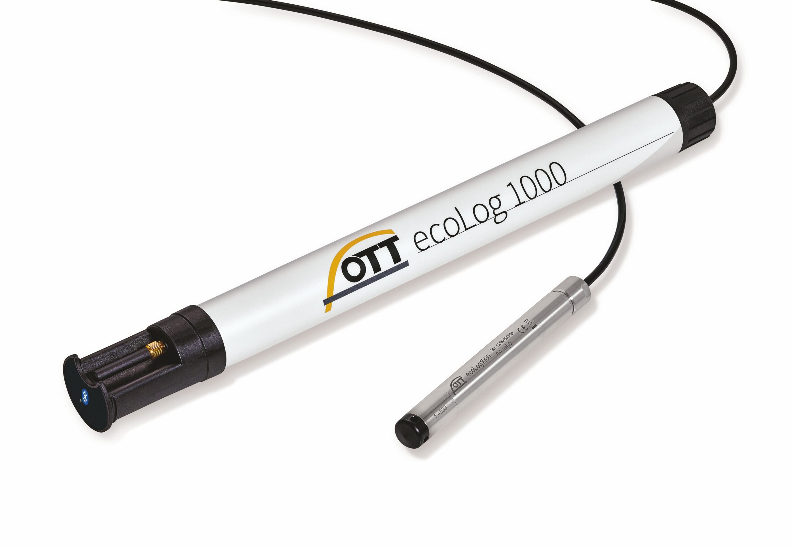
What is a sensible measurement frequency for water level measurement?
A high measurement frequency is crucial for flood monitoring to be able to react to changes in the water level in due time. A sensible measurement frequency is 5 to 15 minutes. This frequency enables the prompt recording of water level fluctuations and the early detection of flood events. Depending on the environmental conditions and risk potential, the measuring frequency can be adjusted to ensure optimum monitoring.
Modern dataloggers make it possible to increase the measurement frequency as soon as a certain threshold is exceeded. This ensures that the station is operated in an energy-saving manner in the “normal state” and that real-time data is available in the event of an incident.
What are flow meters and how do they work?
Flow meters measure the velocity of water flow in rivers and canals. They use methods such as Doppler sensors or electromagnetic induction to provide accurate readings. The water level, information on the flow profile and the flow velocity are then used to calculate the amount of water that is flowing through the measurement cross-section in a specific measurement time.
How accurate are the measurements?
The accuracy of the measurements depends on the quality of the sensors used and the calibration. Modern sensors offer high precision and can measure water levels within a few millimeters. However, the measurement accuracy can only ever be specified for the measurement of the water level and the flow velocity. The accuracy of the flow calculation strongly depends on the local conditions.
Data transmission
What role does data transmission play in flood monitoring?
Data transmission is essential for transmitting measured values in real time. It is usually carried out via wireless networks such as mobile radio or satellite and ensures continuous monitoring. It makes it possible to obtain an overview of all data on the current situation without having to put yourself in danger when accessing the measuring point.
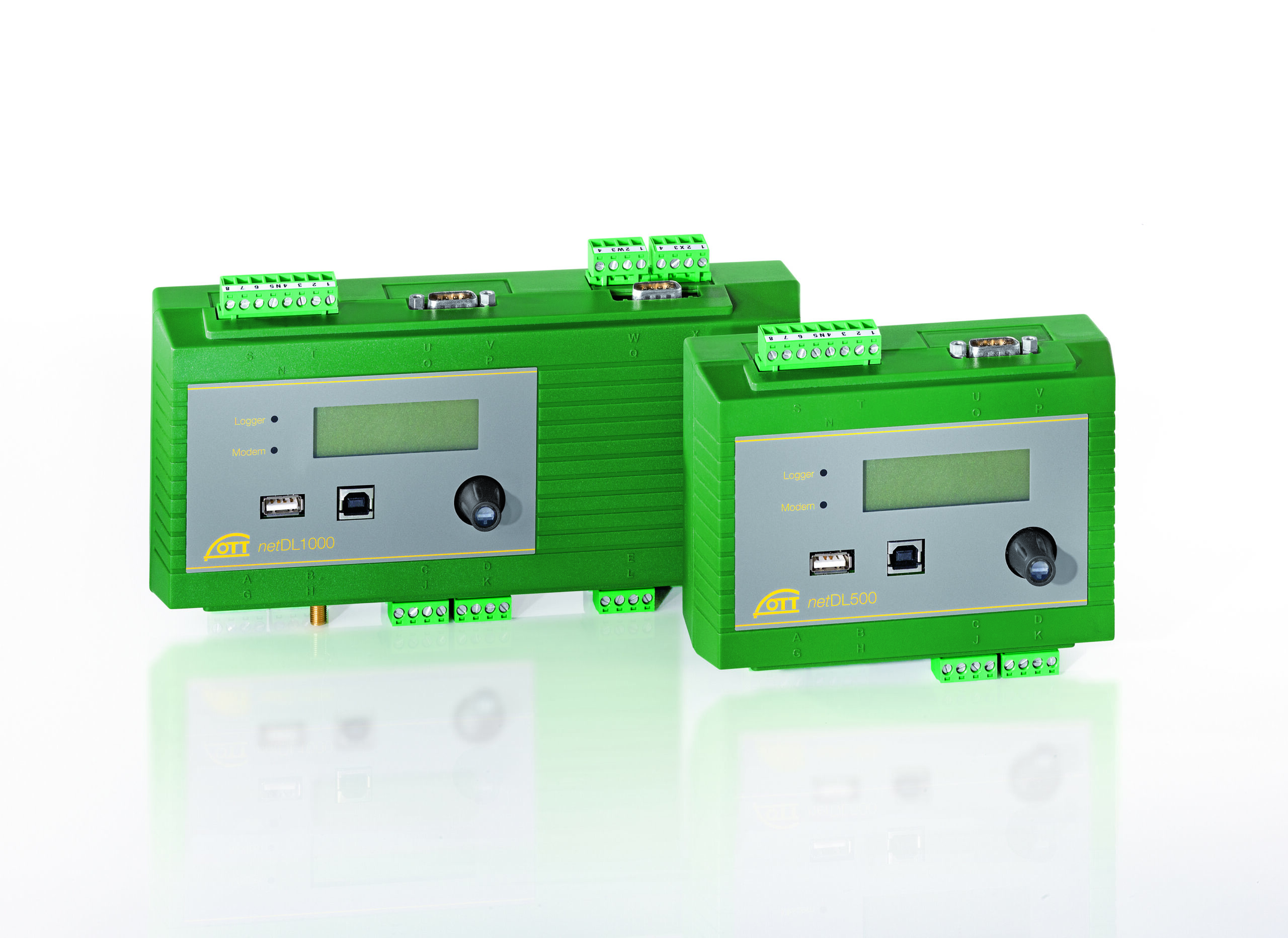
Depending on the importance of the measuring point, the possibility of redundant data transmission should be considered. For example, if the mobile network fails in the event of a disaster, data transmission can continue via satellite. Modern data loggers, such as the OTT netDL, offer this option.
What are the different data transmission options and what are the differences between them?
OTT HydroMet offers various data transmission options for data loggers, each of which has its own advantages and disadvantages.
Cellular
With mobile data transmission, the measurement data is sent to central servers or cloud platforms via the mobile network. There are various standards such as 4G, 5G and LTE-M.
Advantages:
- Widespread network coverage in many regions
- Available for the majority of data loggers
- Easy to set up and maintain
- Fast data transmission in real time
- LTE-M is particularly suitable for monitoring tasks, as the modems are low-power and data transmission is cost-effective. LTE-M is also widely available.
- Data can be sent to a wide variety of servers in different formats. Hosted solutions or self-managed software solutions are possible.
- Systems can be parameterized and configured remotely.
Disadvantages:
- Dependence on the availability of the mobile network
- Possible costs for data transmission
Satellite
Satellite transmission enables communication with dataloggers even in remote and inaccessible areas. It is ideal as a “backup” solution in case other communication channels fail.
Advantages:
- Independent of local network infrastructures
- Highly reliable, especially in the event of disasters
- Free use of Meteosat and GOES (Would this be GOES for the western hemisphere) for public institutions.
Disadvantages:
- No fallback solution when using Meteosat or GOES, but parallel operation
- Latency times can be disruptive depending on the application
LoRaWAN
Description: LoRaWAN (Long Range Wide Area Network) is a wireless transmission technology for the Internet of Things (IoT) that is designed for energy-saving, long-term communication over long distances.
Advantages:
- Low energy consumption
- No costs for data transmission
Disadvantages:
- Limited data transmission rate
- Dependence on the availability of a LoRaWAN network
- Costs and maintenance for the infrastructure
LAN / DSL
Description: Transmission via LAN (Local Area Network) or DSL (Digital Subscriber Line) uses wired connections to send data from data loggers to central servers or cloud platforms.
Advantages:
- High transmission speed
- Stable and reliable connection
- Independent of wireless networks
- Data can be sent to a wide variety of servers in different formats. Hosted solutions or self-managed software solutions are possible
- No costs for data transmission
- Systems can be parameterized and configured remotely
Disadvantages:
- Limited flexibility as a wired infrastructure is required
- Installation and maintenance can be more complex
How often can or should the measurement data be transmitted?
In Most level measurement networks, data is transmitted every 15 minutes. However, data transmission has a major impact on power consumption. In addition, the constant availability of data is often not necessary, especially for flood monitoring. Therefore, an adapted approach is recommended: Normally, data is only transmitted every two hours or even less frequently. As soon as a certain threshold value is exceeded, the data logger automatically increases the transmission rate. Modern data loggers support both automatic adjustment of data transmission and remote modification.
How are alarm systems set up and what methods are there?
Alert systems are set up based on critical thresholds. Methods include sirens, SMS notifications and push messages via apps, as well as the integration of data and alarms into the local disaster control network.
Dataloggers usually only provide the data, everything else is done in the control center or central software. Nevertheless, modern data loggers are also able to send alarms, e.g. via SMS, as soon as a limit value is exceeded. Some data loggers also offer the option of activating sirens or similar via switching outputs.
IT security
The installation of a flood monitoring system requires high security standards to guarantee the integrity, availability, and confidentiality of the data collected. These systems must be protected against various threats, including unauthorized access, data manipulation and cyber attacks.
A crucial aspect of IT security is the implementation of secure communication channels. Data transmission between the sensors and the central servers or cloud platforms must be encrypted to prevent eavesdropping attempts and data leaks. Secure authentication and access control are also essential to ensure that only authorized persons and systems can access the data.
OTT HydroMet, offers products that are specially designed to meet the high security requirements of flood monitoring systems. OTT HydroMet’s devices and software solutions feature advanced encryption technologies for data transmission and secure authentication mechanisms. In addition, they are robust against cyber-attacks and offer comprehensive data integrity and availability features.
Another feature of OTT HydroMet products is their integration into existing IT security infrastructure. This enables seamless collaboration with existing security solutions and processes. This ensures end-to-end protection of flood monitoring data, from collection and transmission to analysis and storage.
Data evaluation
How is the data monitored and evaluated?
The collected data is transferred in real time to central servers or cloud platforms, where it is analyzed and evaluated. Dashboards and alarm systems help to monitor critical threshold values and issue warnings.
How quickly can the data be analyzed?
Modern systems enable data to be analyzed almost immediately. Algorithms and software solutions evaluate the information and generate alerts for critical water levels. AI solutions make it possible to determine the most likely course of events from pre-calculated model scenarios, thus avoiding the long calculation times of complex hydrological models that were previously too long for alerts.
What are the advantages of cloud platforms for flood monitoring?
Cloud platforms offer a scalable and secure way to store and analyze data. They enable access to measurement data from anywhere and facilitate collaboration between different stakeholders.
What software solutions are available for data analysis?
There are various software solutions that are specifically tailored to the needs of flood monitoring. They offer functions for data collection, analysis and visualization and support decision-making.
There is currently a wide range of software solutions available, each with a different focus. There is a fundamental difference between hosted software solutions and on-premises solutions. On-premises solutions are local on your own network. This means that the user is also responsible for maintenance and availability. They have the advantage that you have full control and, above all, can implement security measures almost at will. However, you also must invest your own working time and are responsible for the functionality. With hosted software solutions, this part of the work is purchased as a service. The software solution and the necessary hardware are then operated and maintained by a third-party provider, so that you only must take care of the measuring stations and their data transmission. This generally increases reliability and resilience, provided that the provider has the appropriate qualifications and security measures in place.
In some cases, data platforms already exist at local civil protection organizations or for certain federal states or associations. In this case, it makes sense to import these data in order to benefit from the data together with as many interest groups as possible.
Modern measurement systems also make it possible to import the data into several software solutions in parallel.
Practical applications and examples
How is flood monitoring used in practice?
One practical example is the monitoring of river levels in flood-prone areas. By installing water level gauges and continuously monitoring water levels, local authorities can be warned at an early stage and evacuation plans can be activated.
For example, retention areas in public spaces can be evacuated and cordoned off, and tunnels and underground car parks that threaten to fill up can be closed and monitored in good time. And in the event of an incident, operational planning can be based on which routes (bridges and underpasses) are still passable.
What are the challenges of flood monitoring?
The challenges include installing and maintaining the sensors, ensuring reliable data transmission and handling large volumes of data. It requires close collaboration between different stakeholders to overcome these barriers. The biggest challenge often is managing this additional workload with existing resources. However, with today’s technical solutions and service offerings, these challenges are no longer a major hurdle.
Planning a monitoring network can seem overwhelming at first. But with the right partners at your side, it’s not that difficult. At OTT, we have over 150 years of experience in planning monitoring networks and putting together optimal solutions for various hydrological and meteorological tasks. We are happy to support you in the planning process and provide advice.
Are there funding programs for flood monitoring?
There are government and private funding programs for flood monitoring systems that offer funding and advice. As these programs vary depending on the federal state, please check which offers are suitable for you.
How can flood monitoring data be integrated into GIS systems?
Geographic information systems (GIS) enable the spatial analysis and visualization of flood monitoring data. The integration of this data into GIS systems supports the planning and decision-making process for flood protection measures.
How can private households benefit from flood monitoring?
Private households can be warned of flooding at an early stage by flood monitoring systems. This gives them the opportunity to take protective measures and minimize damage.
How can cooperation between different stakeholders in flood monitoring be improved?
Close cooperation and the exchange of information between municipalities, engineering offices, emergency services and research institutions are crucial to the success of flood monitoring. Regular meetings and joint projects can strengthen cooperation. Sharing data from different monitoring networks offers maximum benefit to each of the stakeholders and allows a holistic view of the situation.
What are the most important criteria for selecting a flood monitoring system?
Important criteria are the accuracy and reliability of the sensors, the reliability, scalability and flexibility of the system, the user-friendliness of the software solutions, and the costs for installation and operation.
Solutions from OTT HydroMet
Conclusion
Flood monitoring is an indispensable tool in the fight against natural disasters. By using state-of-the-art technologies and close cooperation between municipalities, engineering offices and emergency services, the risk of flood damage can be significantly reduced. By relying on effective flood monitoring, we not only protect lives and property, but also contribute to the sustainable development of our cities and regions.
For further information and support, please contact OTT HydroMet.
