2020 will go down in history not only as the year of COVID-19 but also of devastating wildfires. Their consequences reach out far. Harmful plume particles float over thousands of miles, as ceilometers from various countries show.
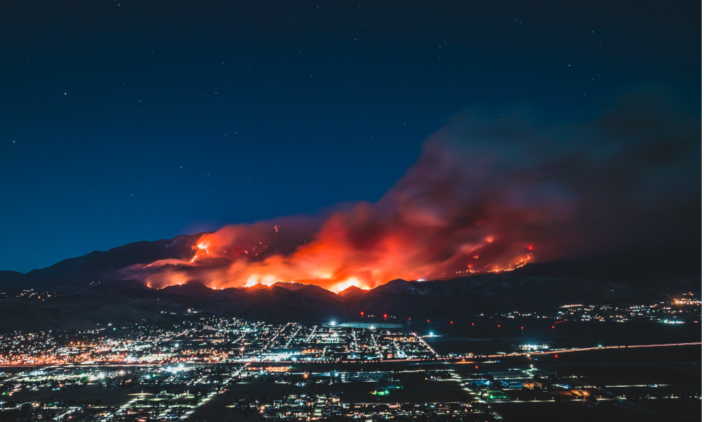
Burning forests and bushes have left swaths of destruction in Australia, Siberia, and, most recently, in Brazil and across the West Coast of the United States. Impressive photos taken from satellites show the dimension of fires and smoke over California, Oregon, and Washington. But it is not only the destruction, that worries scientists. The flames cause massive release of carbon and other harmful particles, many of them too small to be visible. Light as they are, they float around the globe.
Lidar experts confirm atmospheric simulations based on satellite photos
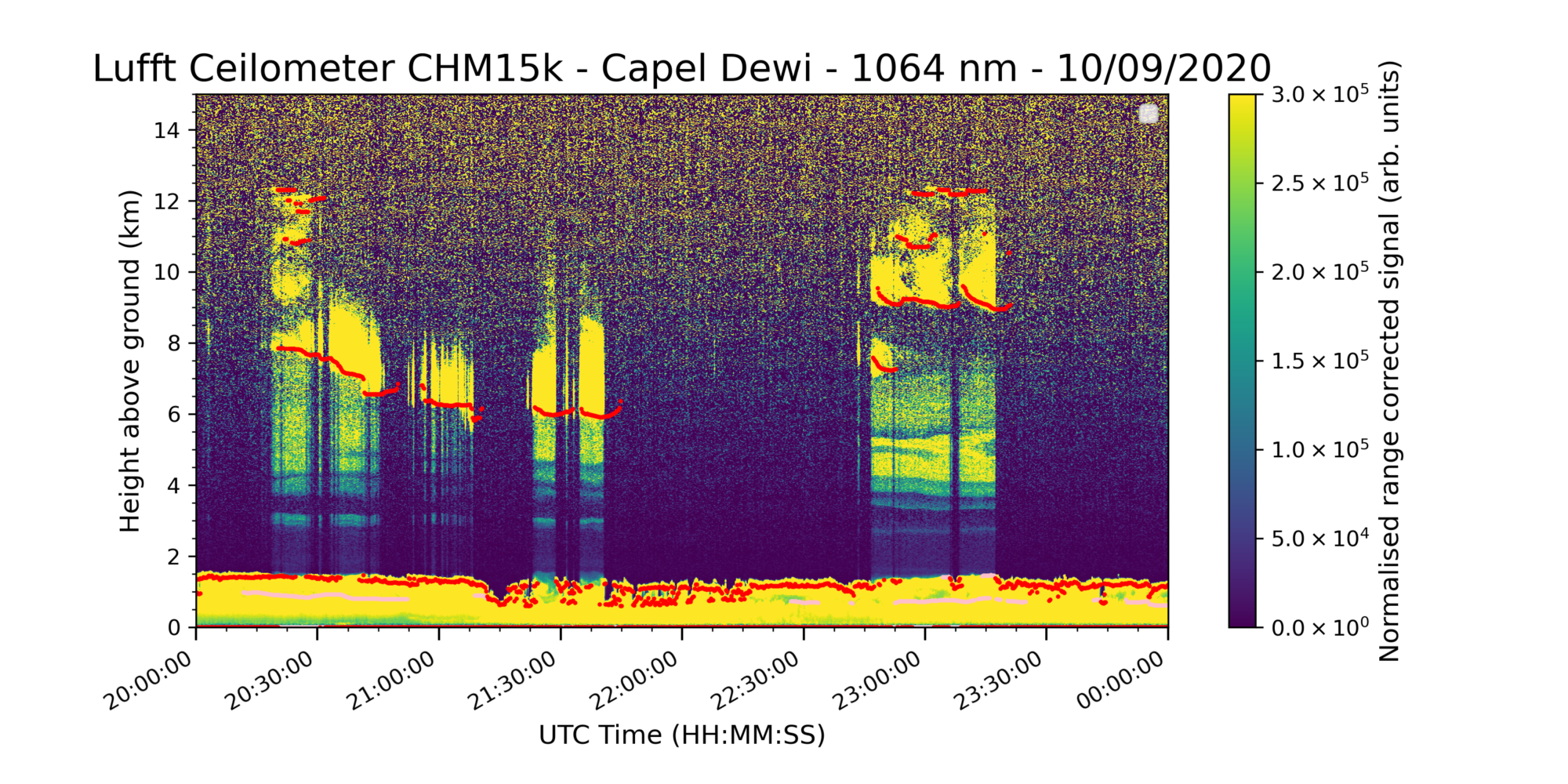
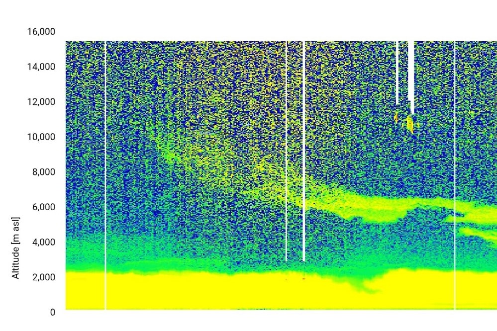
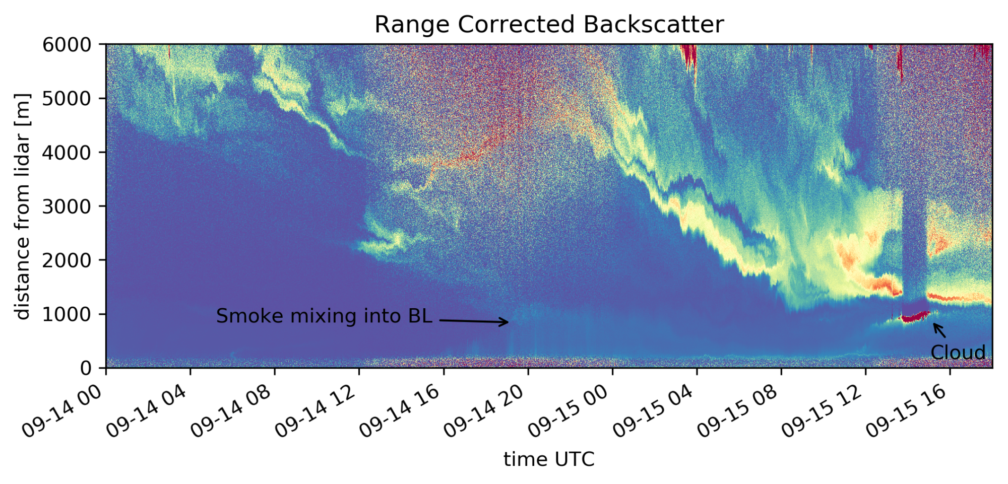
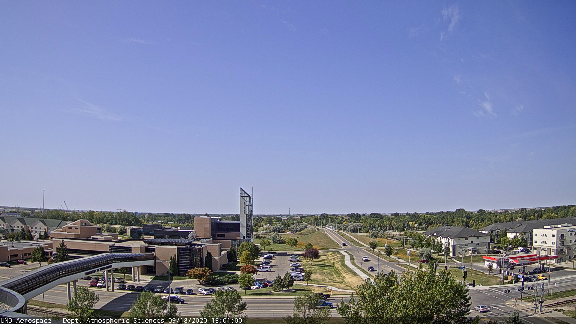
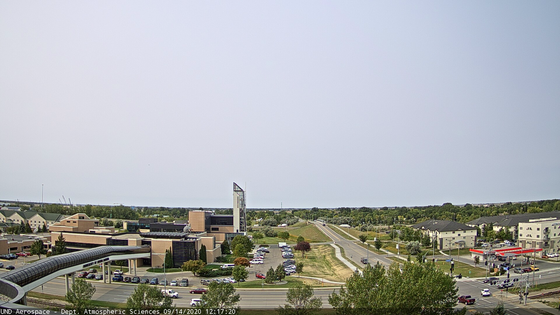
In mid-September, the smoke reached the European continent. This had been foreseen by the Copernicus Atmosphere Monitoring Service (CAMS), whose predictions are based on satellite images and simulations. Now, scientists in various countries have proved CAMS’ forecasts right, detecting smoke coming from the West Coast. Many of them use lidar instruments like the Lufft CHM 15k & CHM 8k. So does Aaron Kennedy from the University of North Dakota. He detected smoke particles on their way eastwards across North America before they reached the Atlantic Ocean.
Kennedy works in the University’s Department of Atmospheric Sciences. He holds a CHM 15k as a part of his versatile equipment. “This summer is the first chance we’ve had to collect ceilometer observations of the smoke. During the events we shared data with our local National Weather Service office. This gave them an idea of how thick and how high the smoke was,” Kennedy says.
Wildfires have various impacts on the weather and air quality
Traditionally, the main purpose of ceilometers is to measure the cloud base height. This is especially relevant for meteorologists and airports. Beyond that, ceilometers are able to detect tiny particles flowing in the air, so-called aerosols. This makes them an important instrument for studies on pollution and air quality.
Wildfires are an ordinary phenomenon and occur yearly. But this year, a lot of them are raging for longer and on bigger areas than usual. Severe fires have a few impacts on the environment and the atmosphere, as Kennedy explains: “First, wildfire smoke scatters energy from the sun and has a cooling impact during the day. Most weather models don’t include smoke, so if a forecaster is unaware, they can go wrong. While the wildfire smoke plumes are usually elevated, sometimes they can mix down to the surface. In this case it hurts air quality. Finally, they change the visual properties of the atmosphere, which results in intense sunsets and in the absence of blue sky.”
Lidars are indeed versatile instruments
In the meantime, the smoke crossed the Atlantic Ocean. Kennedy’s colleagues on the East Coast and in Europe observe smoke plumes with lidar instruments. On September 11, Hugo Ricketts from the Centre for Atmospheric Science at the University of Manchester reported to have seen “some smoky looking aerosol last night in selected cloud gaps”. Croatian and German meteorologists followed a few days later by contributing pictures of their ceilometer measurements taken with the Lufft CHM 15k.
Scientists all over Europe detected smoke originating from the wildfires in the U.S. with help of Lufft ceilometer devices CHM 15k and CHM 8k.
Events like the wildfires show the versatility of ceilometers. For Aaron Kennedy, they can even be combined with other measuring instruments to gain a more elaborate insight in various phenomena. Kennedy, for example, uses an OTT Parsivel², a disdrometer, that detects the velocity and size of particles, mainly precipitation. “The great thing about lidars is they are useful for numerous fields,” he says, “while the wildfire smoke has impacts on things such as visibility and air quality, the traditional use for ceilometers is to provide cloud heights for aviation. For winter weather, it provides information on the height of the blowing snow layer. In some cases, these observations can be combined with radar and we can even retrieve estimates of properties such as particle size.”
Kennedy’s work at the University of North Dakota exemplifies a global trend in meteorology, climatology, and atmospheric science. These disciplines are tied together, and scientists are increasingly investigating the mutual impacts. As the effects of this year’s massive wildfires show, lidar instruments like the Lufft ceilometers help to monitor and understand these phenomena.
Further reading
- Hazy Skies in the Eastern U.S. due to Western U.S. Wildfire Smoke – University of Maryland, BC
- A Devastated West Coast – Reuters
- The long distance harm done by wildfires – BBC
